New Jersey

Resilience System


You are here

Recovery - NJ

Primary tabs

This working group is focused on discussions about recovery.

The mission of this working group is to focus on discussions about recovery.

Members

Kathy Gilbeaux mdmcdonald

Email address for group

recovery-nj@m.resiliencesystem.org

What is My Base Flood Elevation (BFE)? Address Lookup Tool

What is My Base Flood Elevation (BFE)? Address Lookup Tool

(Formerly What is My ABFE?)

The interactive 'What is My BFE?' tool below can help you compare the current effective and the best available flood hazard data for your property (See disclaimer below).  Get information for your property in three easy steps:

1.    Enter your address into the field below and click the “Get Details” button.
***Internet Explorer users: You must click 'No' if a security warning pop up window appears on your screen in order for the report to display correctly after clicking the "Get Details" button.
*** 

Flood Insurance Costs May Soar For Hardest-Hit Sandy Victims

huffingtonpost.com - June 9, 2013 - Katie Zezima and Meghan Barr
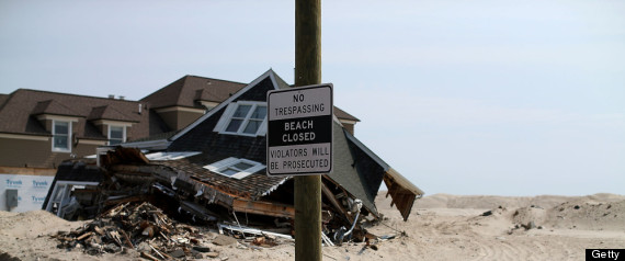
Flood Insurance Costs Sandy

MANTOLOKING, NJ - MAY 15: A beach front home damaged by Superstorm Sandy is tagged to be torn down and hauled off, May 15, 2013 in Manotoloking, New Jersey. Mantoloking officials say that at least 50 homes are scheduled to be demolished in the up coming weeks. (Photo by Mark Wilson/Getty Images)


George Kasimos has almost finished repairing flood damage to his waterfront home, but his Superstorm Sandy nightmare is far from over. ...

That's because the federal government's newly released advisory flood maps have put his Toms River home in the most vulnerable area – the "velocity zone." If that sticks, he'd have to jack his house up 14 feet on stilts at a cost of $150,000 or face up to $30,000 a year in flood insurance premiums....

For many, it's an impossible choice. They can't afford to do either. And many unanswered questions have left residents paralyzed with indecision....

Updated NYC Flood Maps Give Hope To Jersey Shore Residents

What was left of a home in the Good Luck Point section of Bayville, New Jersey after the storm.  Credit PatriciaA.Miller

submitted by Albert Gomez

berkeley-nj.patch.com - by Daniel Nee - June 11, 2013

Jersey Shore residents placed into the dreaded 'V' zone in the Federal Emergency Management Agency's advisory flood maps released in late 2012 may soon see some relief, if an updated round of maps released for New York City residents is any indication.

The federal agency released preliminary flood maps – generally, the second-to-last step before final maps are issued – on Monday.

According to a report by WNYC radio, major swaths of coastal land were removed from the 'V,' or velocity, zone there.

(READ COMPLETE ARTICLE)

View Best Available Flood Hazard Data for New Jersey and New York

Final FEMA Maps to be Posted

mycentraljersey.com - by Ken Serrano - May 31, 2013

FEMA will post searchable versions on its website soon

Sandy victims left hanging by what many have termed FEMA’s confusing and unfair preliminary flood maps will likely have final answers in the coming weeks.

The Federal Emergency Management Agency plans to post searchable maps on its website for homeowners to use to determine their true flood zone and how high they may need to raise their homes to qualify for the best flood insurance rates. Barring any successful challenges, that information will eventually set flood insurance premiums, which won’t go into effect for another 18 months.

FEMA’s working flood maps will be rolled out to coastal counties one by one in mid- to late-June, said Bill McDonnell, the mitigation branch director for FEMA’s Region II, which covers New Jersey.

(READ COMPLETE ARTICLE)

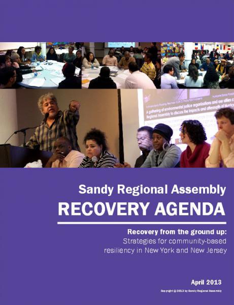
Sandy Regional Assembly - Recovery Agenda

submitted by Jill Cornell

Sandy Regional Assembly - April 2013

A coalition of environmental groups made recommendations this week on how to more effectively allocate Sandy funding.

The Grassroots Recovery Agenda was unveiled by the Sandy Regional Assembly, a consortium of nearly 200 environmental groups from New York City and the surrounding area.

The agenda calls for the integration of regional building efforts with resiliency priorities, the strengthening of vulnerable communities and an expanded view of community-based climate change planning.

Sandy Regional Assembly - Recovery Agenda (16 page .PDF file)

Sandy Regional Assembly recommends Grassroots Recovery Agenda - News Video and Article - bronx.news12.com

Pages

howdy folks