
User login
Language
Anonymous's groups in this site
User is not a member of any group.
Your groups across all your sites
User is not a member of any group.
Recent Content
Who's online
There is currently 1 user online.
- Hank Rappaport
You are here
Updated NYC Flood Maps Give Hope To Jersey Shore Residents
Tue, 2013-06-11 13:19 — Kathy Gilbeaux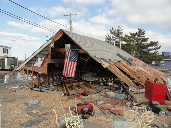
What was left of a home in the Good Luck Point section of Bayville, New Jersey after the storm. Credit PatriciaA.Miller
submitted by Albert Gomez
berkeley-nj.patch.com - by Daniel Nee - June 11, 2013
Jersey Shore residents placed into the dreaded 'V' zone in the Federal Emergency Management Agency's advisory flood maps released in late 2012 may soon see some relief, if an updated round of maps released for New York City residents is any indication.
The federal agency released preliminary flood maps – generally, the second-to-last step before final maps are issued – on Monday.
According to a report by WNYC radio, major swaths of coastal land were removed from the 'V,' or velocity, zone there.
View Best Available Flood Hazard Data for New Jersey and New York
Recent Comments